Pervasive Cityscapes for Visual Exploration on the Internet and Mobile Platforms
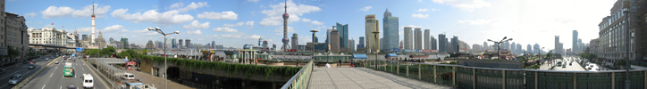
Panoramic View
Comprehensive indexing of spaces through visual links

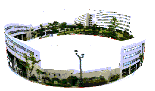
Omnidirection View
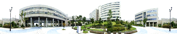
Panorama

VRML 3D Map
Data stored in portable devices for on site area guidance
|
|
Route Panorama
Demonstrations
Publications
J. Y. Zheng, Y. Zhou, P. Mili,
Scanning scene tunnel for city traversing, IEEE Transaction on
Visualization and Computer Graphics. Vol. 12, no. 2, 155-167,
2006.
Hongyuan Cai, Jiang Yu Zheng:
Key views for visualizing large spaces. Journal Visual Communication and Image Representation 20(6): 420-427 (2009)
Jiang Yu Zheng, Bing Zhang, Hongyuan Cai:
Pervasive Scene Map on Wireless Devices for City Navigation. NBiS 2009: 75-82
J. Y. Zheng, M. Shi Mapping
cityscapes into cyberspace for visualization, Journal of
Computer Animation and Virtual Worlds, Vol. 16, No.2, 97-107,
2005. J. Y. Zheng, X. Wang, Pervasive
views: area exploration and guidance using extended image media,
ACM Multimedia Conference 2005, pp. 986-995, Singapore, 2005.